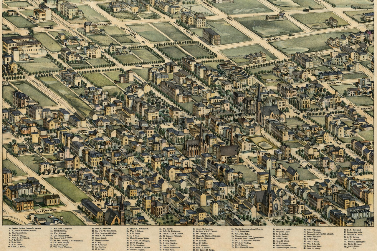
Plate 71 - The Compton and Dry Neighborhood of Lucas and Garrison
This is Plate 71 of the Compton and Dry Pictorial Map of 1875. This area of St. Louis in 1875 was very different than the same area today. There were many mansions inhabited by the very successful and beautiful, ornate churches. The colorized version of the Plate gives it more definition

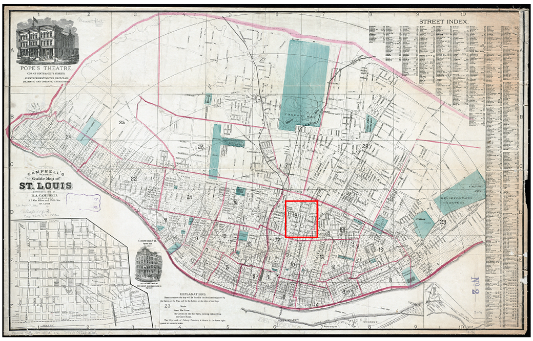
1882 Saint Louis Map with Designation of Location of Plate 71
This map was produced in 1882. There was a street map produced in 1870, but the quality of that map was poor and the resolution did not allow for close observation of the area of interest. This 1882 map shows the exact same neighborhood streets with much more definition. The approximate area of Plate 71 is shown by the bright red outline.
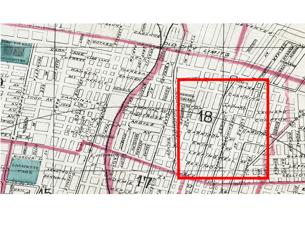
Close Up of Plate 71 Area on 1882 Saint Louis Map
This close up of the 1882 map shows the streets included on Plate 71. You can easily find the intersection of Lucas, (which is now Samuel Shepard Boulevard), and Garrison.
Current Street Map of Saint Louis with the Area Where Plate 71 Would Have Been Located
The current map of the area including the neighborhood of Plate 71 is very different form the neighborhood in 1875. This map designates the current location of Powell Hall on Grand Avenue and Chaifetz Arena on the campus of Saint Louis University. The intersection of Lucas and Garrison is circled.

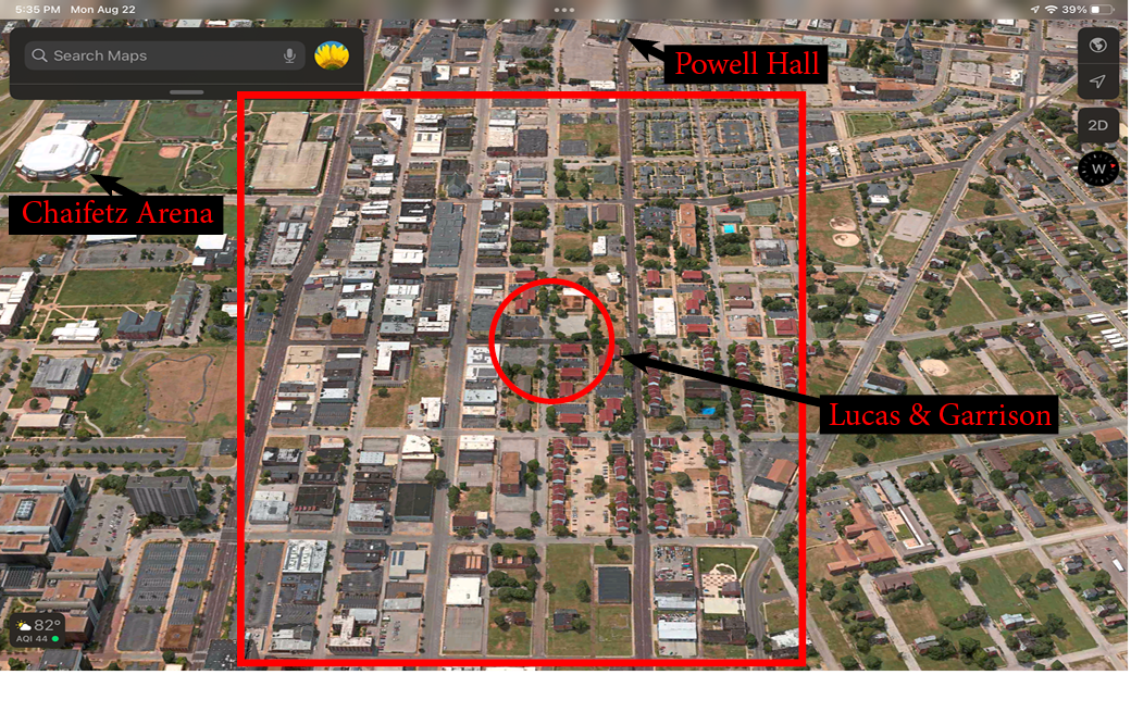
Current Arial Map of Saint Louis
This arial map of Saint Louis shows the current approximate location of the 1875 Compton and Dry Plate 71 outlined in bright red. The intersection of Lucas and Garrison is designated by the red circle. To help get your relative bearings, Powell Hall on Grand Avenue and the Chaifetz Arena on Compton, part of the Saint Louis University Campus, are identified
Remarkably, there is not a single building which was depicted on the 1875 map that still exists today. Many neighborhoods in Saint Louis changed and evolved over the decades, but few have no remaining remnants of the past. This phenomena is explained elsewhere through the study of the Mill Creek Valley just south of the Lucas and Garrison neighborhood.
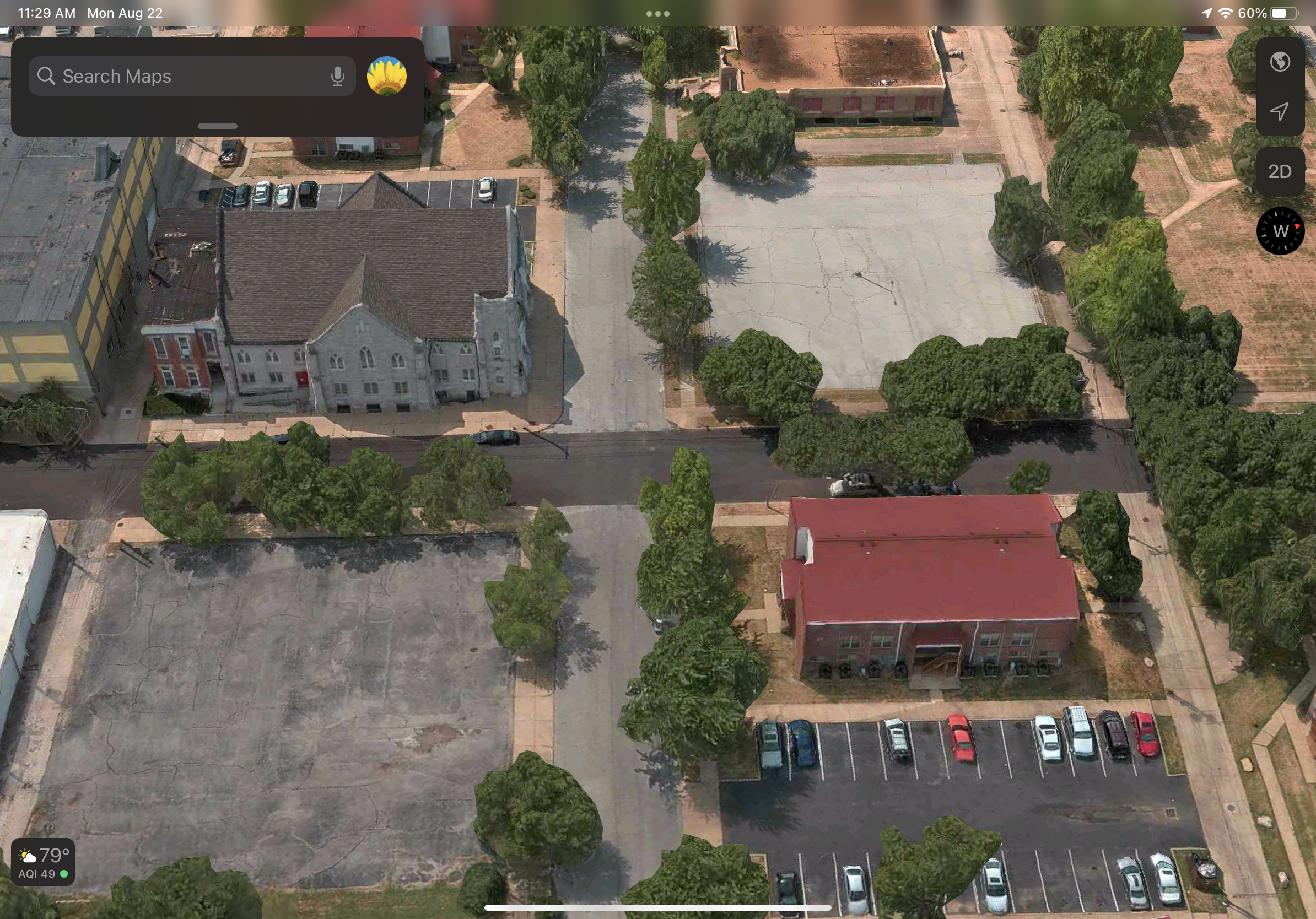
Close Up of the Intersection of Lucas and Garrison today.
Today on the northeast corner of Lucas and Garrison which was previously the location of Central Presbyterian Church, there is an apartment building. Across Garrison Avenue, there is an old stone church building which would seem to have possibly been in place in 1875. The church was founded in 1865. But through further research, that building was built in 1880, five years after the completion of the maps. Looking at Plate 71, you can see that the current location of the church was an empty lot in 1875.